Buscar

 Using Open Street Maps data and tools for indoor mapping in a Smart City scenario
(AGILE Digital Editions, 2014-06)
This paper explains the experience of implementing a Smart City scenario using Open Street Maps tools and data. An indoor mapping
system including not only a localization and navigation solution, but also a natural speaking ...

Capability of movementfeatures extracted fromGPS trajectoriesforthe classification of fine‐grained behaviors
(AGILE Digital Editions, 2014-06)
Recent advances in tracking technologies provide an unprecedented opportunity for a better understanding of animal movement. Data from multiple sensors can be used to capture crucial factors deriving the behaviors of the ...

Is this Twitter event a disaster?
(AGILE Digital Editions, 2014-06)
Social media services such as Twitter have become an important channel for reporting real-world events. For example, they can describe the current situation during a disaster. The decisions in crises management are based ...
Real-time detection of anomalous paths through networks
(AGILE Digital Editions, 2014-06)
The proliferation of increasingly inexpensive mobile devices capable of transmitting accurate positional information to other devices and servers has led to a variety of applications ranging from health situation monitoring ...
Workforce Demand Assessment to Shape Future GI-Education – First Results of a Survey
(AGILE Digital Editions, 2014-06)
Geographic Information Science & Technology (GIS&T) is constantly evolving in scientific and technological terms. In 2006 the GIS&T
Body of Knowledge (BoK) initiative has provided a domain inventory that serves as a ...
Latest Developments and activities in the Spanish NSDI
(AGILE Digital Editions, 2014-06)
The Spanish NSDI Geoportal was opened on June 2004 and has evolving continuously with the support of a healthy collaborative community composed by public and private sector, academia and citizens. INSPIRE Directive has ...

Spatiotemporal data complexity in electronic airport layout plan and its visualization
(AGILE Digital Editions, 2014-06)
Airports GIS is a web portal consisting of a few application modules. It allows authorized users of FAA (Federal Aviation Administration) to submit changes to airport data. One of these applications is electronic Airport ...
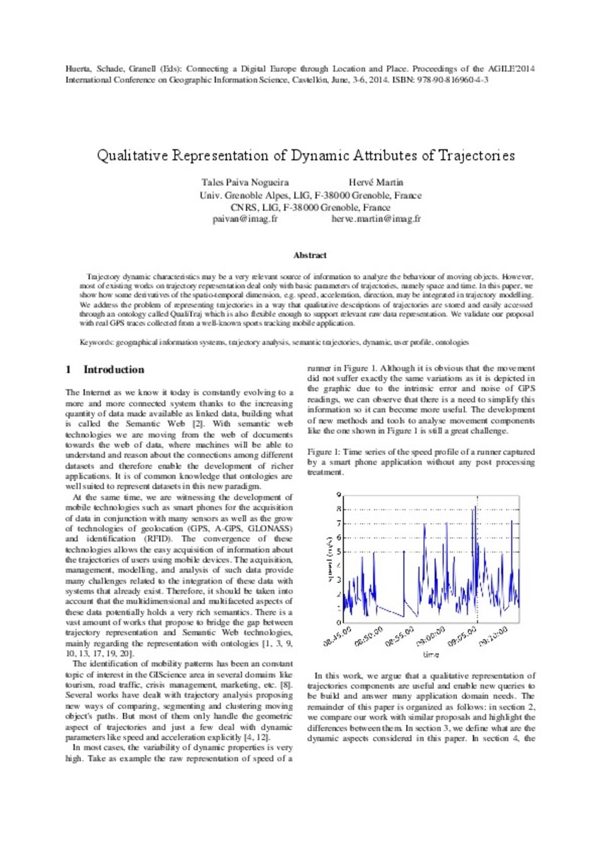
Qualitative Representation of Dynamic Attributes of Trajectories
(AGILE Digital Editions, 2014-06)
Trajectory dynamic characteristics may be a very relevant source of information to analyze the behaviour of moving objects. However, most of existing works on trajectory representation deal only with basic parameters of ...

Planned vs. Real City: 3D GIS for Analyzing the Transformation of Urban Morphology
(AGILE Digital Editions, 2014-06)
Cities are constantly evolving: buildings are built and demolished, altering the landscape of our cities; Urban Plans describe what we want
our cities to be, undergoing revisions as we change our vision of the future of ...

VGI Edit History Reveals Data Trustworthiness and User Reputation
(AGILE Digital Editions, 2014-06)
Volunteered Geographic Information (VGI) is an approach to crowdsource information about geospatial features around us. People around the world are engaged with typing in their observations about the world (like locations ...


