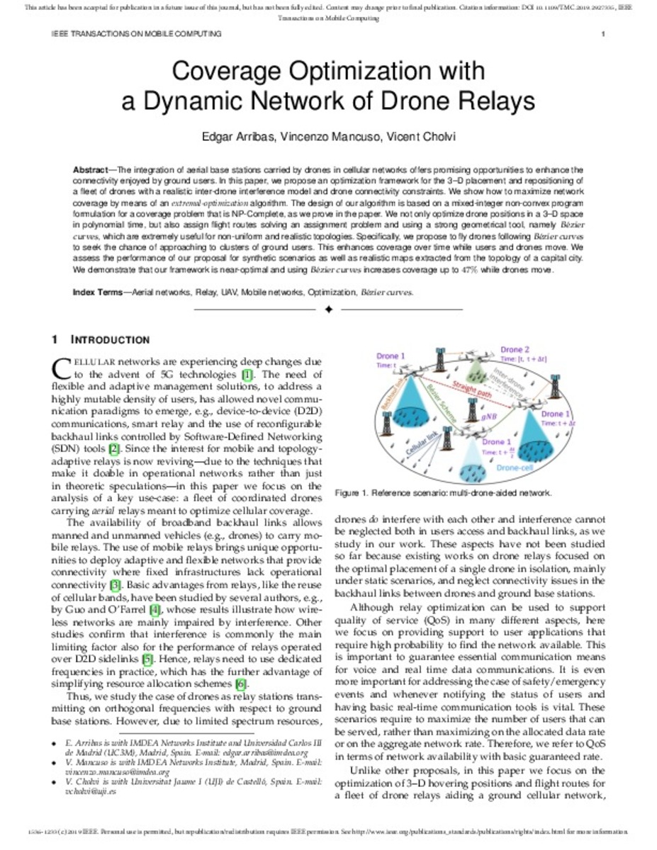
Coverage Optimization with a Dynamic Network of Drone Relays

Metadades
Títol
Coverage Optimization with a Dynamic Network of Drone Relays
Data de publicació
2019-07-09Editor
Institute of Electrical and Electronics Engineers; IEEEISSN
1536-1233; 1558-0660Cita bibliogràfica
ARRIBAS, Edgar; MANCUSO, Vincenzo; CHOLVI, Vicent. Coverage optimization with a dynamic network of drone relays. IEEE Transactions on Mobile Computing, 2019, vol. 19, no 10, p. 2278-2298.Tipus de document
info:eu-repo/semantics/articleVersió de l'editorial
https://ieeexplore.ieee.org/xpl/RecentIssue.jsp?punumber=7755Versió
info:eu-repo/semantics/acceptedVersionParaules clau / Matèries

Resum
The integration of aerial base stations carried by drones in cellular networks offers promising opportunities to enhance the connectivity enjoyed by ground users. In this paper, we propose an optimization framework ... [+]
Publicat a
IEEE Transactions on Mobile Computing ( Volume: 19, Issue: 10, Oct. 1 2020)Entitat finançadora
Ministerio de Educación, Cultura y Deporte | Ministerio de Economía, Industria y Competitividad | Ministerios de Ciencia e Innovación y de Universidades
Codi del projecte o subvenció
FPU15/02051 | RYC-2014-16285 | TIN2017-88749-R
Drets d'accés
http://rightsstatements.org/vocab/CNE/1.0/
info:eu-repo/semantics/openAccess
info:eu-repo/semantics/openAccess
Apareix a les col.leccions
- LSI_Articles [362]


