Cerca

 A conceptual representation for modelling the synchronization process of complex road networks
(AGILE Digital Editions, 2014-06)

Using Open Street Maps data and tools for indoor mapping in a Smart City scenario
(AGILE Digital Editions, 2014-06)
This paper explains the experience of implementing a Smart City scenario using Open Street Maps tools and data. An indoor mapping
system including not only a localization and navigation solution, but also a natural speaking ...

Using Crop Phenology to Assess Changes in Cultivated Land after the Anfal Genocide in Iraqi Kurdistan
(AGILE Digital Editions, 2014-06)
The Anfal genocide campaign, carried out by the Iraqi government against the Kurdish population in 1988, has been reported to have severe
consequences for agriculture and food security by causing large scale land ...
Improving equity of public transportation planning. The case of Palma de Mallorca (Spain)
(AGILE Digital Editions, 2014-06)
Public transport planning requires consideration of equity in access of the population to the transport service. This paper presents a methodology for the analysis of public transport in the city of Palma and its evaluation ...
Data Scarcity or low Representativeness?: What hinders accuracy and precision of spatial interpolation of climate data?
(AGILE Digital Editions, 2014-06)
Data scarcity is a major scientific challenge for accuracy and precision of spatial interpolation of climatic fields, especially in climatestressed
developing countries. Methodologies have been suggested for coping up ...
How to visualize the geography of Swiss history
(AGILE Digital Editions, 2014-06)
Efficient and effective access to and knowledge construction from massively growing spatial and non-spatial databases available online today have become major bottlenecks for the rapidly evolving information society at ...
Agile access to sensor network
(AGILE Digital Editions, 2014-06)
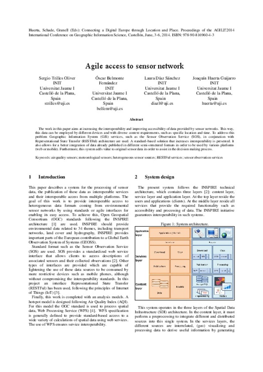
The work in this paper aims at increasing the interoperability and improving accessibility of data provided by sensor networks. This way, this data can be employed by different devices and with diverse context requirements, ...
Evaluation of subjective preferences regarding indoor maps: comparison of schematic maps and floor plans
(AGILE Digital Editions, 2014-06)
In this study, we investigate subjective preferences regarding floor plans and schematic maps in the use of a map in an indoor environment. To achieve this, we performed a qualitative experiment with a random user sample; ...
Fuzzy viewshed, probable viewshed, and their use in the analysis of prehistoric monuments placement in Western Slovakia
(AGILE Digital Editions, 2014-06)
Viewshed analysis is used in many fields (e.g. landscape architecture, military, or archaeology) to determinate locations visible from one or more observation points in order to examine suitability of the placement of ...
Geo-Information Visualizations of Linked Data
(AGILE Digital Editions, 2014-06)
Linked Data provides an ever-growing source of geographically referenced data for application development. In this paper, we analyse
the workflow behind the development of such an application. Using two examples based ...


