Cerca

 IDE-OTALEX C. The big challenge of the first Crossborder SDI between Spain and Portugal
(AGILE Digital Editions, 2014-06)
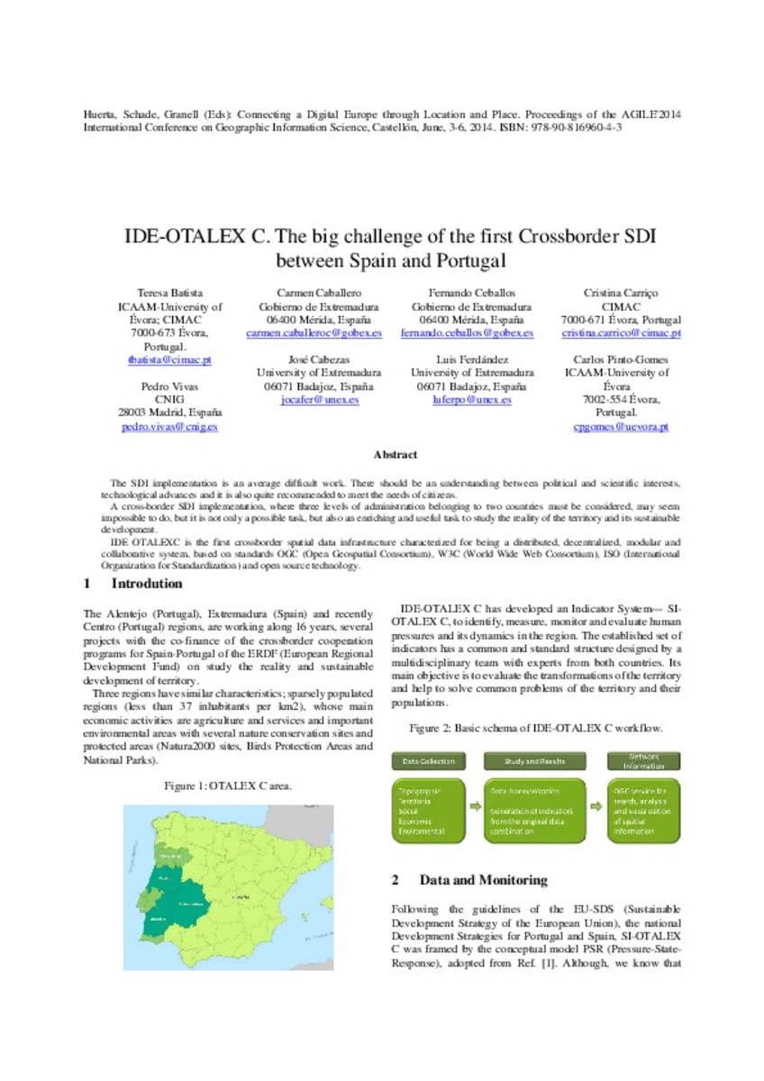
The SDI implementation is an average difficult work. There should be an understanding between political and scientific interests,
technological advances and it is also quite recommended to meet the needs of citizens.
A ...
Enhancing the role of Citizen Sensors in Mapping: COST Action TD1202
(AGILE Digital Editions, 2014-06)
This article introduces a strategic initiative, COST Action TD1202, focused on the role of citizen sensors in mapping. It outlines the Action’s scope, aims and current status. In particular, the article outlines the potential ...
Noise map: professional versus crowdsourced data
(AGILE Digital Editions, 2014-06)
The goal of the recent study is to evaluate the usability of the data measurement capability of an average smartphone and make a comparative study on available open source mobile applications potentially suitable to noise ...

FOODIE: Farm‐Oriented Open Data in Europe
(AGILE Digital Editions, 2014-06)
The agriculture sector is a unique sector due to its strategic importance for both European citizens (consumers) and European economy
(regional and global) which, ideally, should make the whole sector a network of interacting ...

Publishing metadata of geospatial indicators as Linked Open Data: a policy-oriented approach
(AGILE Digital Editions, 2014-06)
Geospatial indicators are becoming increasingly important for governments in monitoring and underpinning policy planning and political decision making. Currently, the discovery, viewing and sharing of these indicators is ...

Linking crowdsourced observations with INSPIRE
(AGILE Digital Editions, 2014-06)
The combination of spatial data from the variety of sources on the web, being either legislative, commercially or voluntarily driven, is a major requirement for the establishment of a fully integrated geospatial web. ...

Applying a CA-based model to explore land-use policy scenarios to contain sprawl in Thessaloniki, Greece
(AGILE Digital Editions, 2014-06)
This study addresses the issue of urban sprawl through the application of a Cellular Automata (CA) based model in the area of Thessaloniki, Greece. To link macro-scale to micro-dynamic processes the model integrates a ...

SDI strategic planning using the system dynamics technique: A case study in Tanzania
(AGILE Digital Editions, 2014-06)
Development of spatial data Infrastructure (SDI) is a long term process, which requires long-term plans. The complexity of SDI, which is a matter of technical, institutional and financial challenges and their interactions, ...

SOS Server Deployment for Sharing Environmental Sensor Data Through the OTALEX-C Spatial Data Infrastructure
(AGILE Digital Editions, 2014-06)
OTALEX Spatial Data Infrastructure (SDI) project is funded by the INTERREG III European Programme and its main objective is to study and show the reality of the territory composed by the regions Alentejo in Portugal and ...


